Wednesday, 5 October 2016

St Moritz Trails Part 5: Behind the Mountain

Val Roseg

When you think you've explored all that St Mortiz has to offer - circled the lakes up the valley; explored the valley around Celerina, Samedan and beyond; ran the forest trails to the east of the town; even tested out the mountain routes to the north and west - there are still surprises awaiting.

Looking at my treasured map the other morning, I felt that there couldn't be many more surprises - sure, there were paths and trails that I'd never reach on, but after two visits I felt that I had a good feel of the area and all that there was on offer.

But there was one possible option left. My map showed a valley at the back of the mountains south of the town, and the access from Pontresina seemed pretty flat. Only problem was that I knew that it would take almost 30 minutes to get to Pontresina - if I was going to make this, I'd have to do longer than the planned 60 min run.

And so off I set...


From Lej da Staz, take the trail behind the restaurant towards Pontresina. The first section is slightly uphill, but then it's gradually downhill all the way towards Pontresina station where the trail comes to an end.


Leaving the station to your left, follow the road for a couple of hundred metres past some houses until it veers right just before the river and turns into a trail again. Do not cross under or over the railway line at any point.

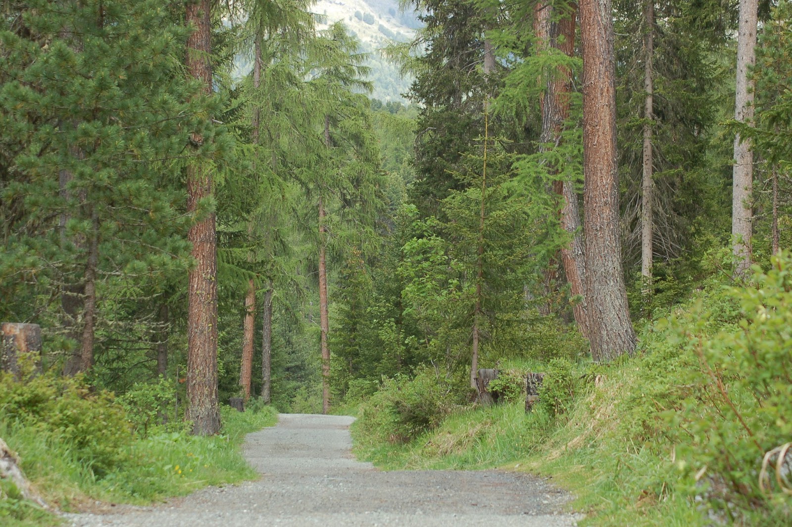
The trail here is wide, level and gradually uphill, and stretches on for miles up the valley. At first it looks like it is one long straightway with spectacular - but similar - scenery as far as the eye can see. But the scenery does change. There are more trees in parts, cool waterfalls, and as the path gently meanders up the valley you get different perspectives of the mountains. You even cross a bridge to the other side of the river at one stage! The incline does also get a bit steeper in places, but the route is so beautiful you hardly notice.


Don't forget to look up. The glacier covered Corvatsch peak is straight ahead, and mid-summer offers a surprising winter feel to this outdoor wonderland.


I ran the route as a simple out-and-back; the mountains gave me little other option, though it is possible to do a circular route if you don't mind a fairly serious mountain climb. The range is at its lowest at Fuocla Surlej on the town side of Corvatsch (still 2755m mind!), with the decent towards Silvaplana. If your fit and up for a challenge, this has got to be a pretty spectacular route. The Scott Engadin St. Moritz Mountainbike Map suggests doing this route in the opposite direction. It rates the route as 'technically demanding over long distances'.


Enjoy!

Tuesday, 4 October 2016

St Mortiz Trails Part 4: Down the Valley

Celerina, Samedan, Bever and beyond

Down stream from St. Mortiz, the valley widens to offer an almost endless choice of flat trails in the Celerina/Samedan area. This is where I've been happily doing my long Sunday runs, and while not as pretty as the lakes around St. Moritz - it's a very high standard to be fair - the area offers nice variety and, apart from the final climb back to the town, miles and miles of perfectly flat ground.


From St. Moritz simply head towards Celerina via any one of a number of routes. You can run via the forest and Lej da Staz to Celerina station as described in my best of East of the Lake post; head all the way to Pontresina and back the Flax valley towards Celerina; take Via Meistra from St Moritz Dorf (past the Bobsleigh course), or simply down the path beside Via Grevas from the lake.


Once you approach Celerina you can simply take any of the marked paths down the valley away from St Moritz. The valley is littered with trails, all running practically parallel to each other, with paths and bridges connecting them at various points.


The main paths are alongside the two main rivers - The En/Inn which flows from St Moritz, and the Flax, which flows from Pontresina. There are other paths alongside the various ponds and smaller tributaries in the area, along the edge of the mountains (particularly from Bever onwards) and a flat, surfaced path - used for inline skating - around the airport runway.


With mountains at either side of the valley, it's difficult to get lost, so just take a path in the right general direction, follow it to your heart's content, cross a bridge and head back via a different route. 


Just remember to keep enough energy for the final wee climb back to the town!

 ...just a few more shots...

Saturday, 1 October 2016

St Mortiz Trails Part 3: The Other Lakes

Lej da Champfèr, Lej da Silvaplauna and Lej da Segl

While Lej da San Murezzan forms the focal point of the town and the path around it is a great starter running route, it is far from the only beautiful lake or flat running route in the area. For a whole new world of beauty and a great trail network, head roughly south west from St Moritz Bad along the edge of the river En valley, towards Champfèr.


As you approach Champfèr, you'll reach a footbridge across the river. You can choose to go left of the river from here, along the edge of the forest, or take the more open route on the Champfèr side of the river (or better still, take one route out and the other back. The route on the Champfèr side is marginally longer, and also wider and more level, though the route on the forest side is also very runnable, but slightly rocky as you reach Silvalpana/Surlej.


When you reach the bridge between Silvaplana/Surlej, cross the bridge, and take the path to the left (Surlej side) of Lej da Silvaplauna. There is a path at the Silvaplana side, which runs along by the kitesurfing and windsurfing centres, but ends at the campsite.  The first section of the path is through open grassland, slightly above the level of the lake, but as it meets the forest it rejoins the lake edge. On a calm sunny morning, the vistas from here are particularly spectacular. On a windy Saturday afternoon, the lake will be a blaze of colour as windsurfers and kitesurfers get their weekly adrenaline rush.


At the far side of the lake, you'll reach Sils im Edigan/Segl. If you are going for a really long run, you can carry on through Sils/Segl and run alongside Lej da Segl to Maloja. Those of us with purely human qualities, however, will likely have reach our limits long before this point, and will have turned and headed back towards St Moritz - I have not comments to make on this section of the run; I simply didn't make it that far. 


It's approximately 10km from St Moritz to Sils, and a further 6km to the far side of Lej da Segl. This is a mostly flat route, though you can add hills if you please - the forests to the south of the lakes provide plenty of opportunity to do so.

Friday, 30 September 2016

St Moritz Things to Do Part 3: Take in the Olympic Sites

St Moritz hosted the Winter Olympics in 1928 and 1948 and is getting set to host the 2017 FIS Alpine World Ski Championships. It's difficult to avoid the excitement in the town surrounding next February's event - countdown clocks, posters, banners, that sort of thing - but sites and points of interest from the previous Olympics can also still be seen around the area.

The facilities which the town seems most proud of are the bob and skeleton routes used for the Olympics. When I first visited St Mortiz in 2010, I visited the start of these, acknowledged their existence, and thought nothing more of it. But when I spotted this guy (picture below) when taking the bus from St Moritz to Samedan, and realised how close it is to the road, I just had to see exactly where the course went. And so, on Sunday last, 501 days before the opening of the 2018 Games in ‎Pyeongchang,‎ I took a little trip down Winter Olympic history.


St Moritz and the Winter Olympics
St Moritz is the birthplace of resort holidays and one of the oldest ski resorts in the world. It hosted the second edition of the Winter Olympics in 1928 (Chamonix in France hosted the first) - which saw 464 athletes from 25 nations compete for 14 sets of medals in six sports - and again in 1948 when it's neutrality during World War II made it the ideal candidate and the existence of the 1928 facilities gave it a head start in the relatively short run-in period. This time, 669 participants from 28 countries competed for 22 sets of medals in alpine and Nordic skiing, bobsleigh and skeleton, figure skating, speed skating and ice hockey.

St. Moritz-Celerina Olympia Bobsleigh Run
Switzerland won 10 medals at the 1948 Games, including gold and silver in the two-man bobsleigh, and it is the bobsleigh run that forms one of the main remaining Olympic sites of interest. The track is constructed from scratch every year and is the only naturally refrigerated bobsleigh run in the world. It was first used in 1904, making it the world's oldest too.


Following the first snow in mid-late November, the skilled workers take three weeks to construct the track using about 15,000 cubic metres of snow and 7,000 cubic metres of water. Technology means that the construction has gotten somewhat easier over the years, but this is still a very labour intensive task. While the same track area is used each year, and great care is taken to level out the ground exactly, the natural construction means that there are minimal changes in the alignment from year to year - adding an extra skill element for the bobsleigh drivers. 

This video gives you some idea of how, each winter, the summer route is turned into 'the largest ice sculpture in the world'.


There is also a great selection of photos showing track construction on the track's website.

During the summer months you can take a walk down the course and get some sense of what it might be like to ride the 1,722 metre track at more than 130 kph. The start is off Via Maistra, just beyond the Klum Hotel.


If you visit during the winter you can experience the run for yourself in a 4-man bob (with an experienced driver). But you might want to start saving now - the cost for this 75 second run is 250 CHF (about €225); that's more than €3 per adrenaline-filled second!

The Cresta Run
The Cresta skeleton course - one of the few tracks in the world dedicated solely to skeleton - can be accessed just across the road from the Bob Run (the junction entrance), though it's start (top) is a bit higher, close to the leaning tower and Cresta monument. It's finish is just beyond the finish of the bob run, close to the village of Celerina. Like the bob run, the Cresta Run is constructed freshly each year. It using the natural topography of the hill, and banks of earth as a buttress for iced packed snow.


The sport of skeleton originated and developed in the Graubünden region of Switzerland, and was featured on the Olympic programmes in both 1928 an 1948 - the only occasions it was contested until it was added permanently to the programme in 2002; the year in which women also first contested skeleton at Olympic level.


The run is owned and operated by the all-male St. Moritz Tobogganing Club (SMTC) created by British military officers in 1885. Women have been excluded from the course since the late 1920s, because of injuries sustained by female racers and the never proven belief that excessive sledding causes breast cancer. Women are sometimes, by invitation, allowed to race from the Junction start only. St. Moritz has hosted 22 World Bobsleigh/Skeleton Championships, but these races have been held on the bobsleigh course.

The Olympic Stadium and other sites
The Olympic Stadium - now a driving range and located close to the start of the bobsleigh run - hosted the opening and closing ceremonies for the Games, as well as the skating events. The stadium building is essentially unaltered since 1948 on the outside; internally it has been converted into residential apartments.


Nearby, the Klum Pavilion, which also played a role in the Olympic Games, is currently being restored and will be used for the medal presentation for the 2017 FIS World Championships.


The original Olympic ski jump (Olympiaschanze), which had been in use until 2006, was still in place when I visited in 2012. The original jump has since been taken down and the area is currently a construction site. According to the St Moritz website: 'The regular ski jump is being rebuilt (hill size 106 m), with the addition of a new training ski jump (67 m). Two jumps for younger skiers (47 m and 17 m) are also being renovated and fitted with mats for use in summer.'


Finally, the Olympic stone, which commemorates St. Moritz hosting the Games on two occasions and lists the medal winners from both Games, is located at Plazza Paracelsus 2, just off Via Mezdi, in St. Moritz Bad (by the swimming pool).


Friday, 23 September 2016

St Moritz Things to Do Part 2: Take Your Camera on a Little Walk

St Moritz is not just one of the most beautiful places that I've been; it's also one of the most photogenic. Water and mountains both have the ability to look different every time you view them, and St Moritz has the perfect combination for an ever changing vista.

When out for my run in the chilly morning air, I had a feeling yesterday was going to be a special day. It was sunny like the previous two mornings had been, but the lake was like I'd never seen it before. Smooth as glass, it was reflecting the town and the mountains in almost perfect symmetry, just like I'd seen in other people's photos. Now, if only I could get this run finished, get showered and breakfasted, grab my camera and get back down before the clouds came out.

As you can see, I made it! I was confident I'd captured some dream shots as I made my way around the lake. Unlike other days, it never did cloud over, and I'm sure the mercury reached the high teens - much warmer than any other day I've been here. However, by the time I'd reached the far side of the lake, the wind had gotten up - the 'celebrated' Maloga winds, according to the Engadin St. Moritz guide, are typical of a sunny summer afternoon, and usually rise around midday - and, within seconds, the reflections had completely disappeared. The lake took on a completely different look, and as if they'd expected it, two sailing boats suddenly appeared.

But don't let a little bit of wind get in the way of a good shot! It's hard to believe this is the same lake as above.


And of course, it's not just the time of day that the vista changes with; theses two shots are taken from roughly the same sport, just at opposite ends of summer - the first was taken on my first visit in June 2012; the second yesterday (September 2016).


St Moritz's beauty has even inspired me to work out how to create panoramic shots. The lake is an obvious subject...


...though the panoramics are also pretty special from the top of the mountain!


Top spots to get some photos:
1. Anywhere by the lake, any time of day, any day of the year, but the sunny mornings, before the wind gets up, make even the most novice photographer look professional.

2. The mountains - the higher the better, and bright sunny days are best, but even the clouds make for interesting shots.


3. Lej de Staz, hidden in the forest east of St. Moritz, is a strangely mysterious place, and offers some interesting shots of water, trees, mountains and clouds


4. The forest trails also provide an interesting subject

But, basically, anywhere by the lakes, in the forests, up the mountains, or down the valley will provide beautiful photos. Be sure to pack your camera!

Wednesday, 21 September 2016

St Moritz Things to Do Part 1: Funicular and Cable Car to Piz Nair

And ideally back down again!

Gifting myself an afternoon off training, I decided to make the most of another sunny afternoon and head to the top of the mountain. Piz Nair, at 3057m above sea level, was the destination, and the funicular and cable car were the mode of transport. The plan was to return to the town on foot. It would be all downhill; how difficult could it be?


Starting right in the heart of St Moritz Dorf (the posh part of town), the funicular takes an almost vertical route to Corviglia (2,486m), which from the lake seems like pretty much as high as you can go. The views from there are pretty amazing, and I was surprised to see so many other people up there, many of whom, it seemed, had arrived by bike. Fair play to them!


After snapping some snaps, and putting on an extra layer of clothing (it was pretty cool up there) I made my way to the cable car terminal, ready for the rid to the peak up ahead. It looked like a steep ride (and a rocky decent) but thankfully I'm not afraid of heights.


Only, as we approached that peak (which indecently, and scarily, will host the start of next February's World Downhill Skiing Championships), I realised we weren't stopping; we were going even higher! There was a further peak which I had missed in the clouds ahead.


The cable car stopped at 3022m; it was just a short, rocky hike from there to the very top. The views took my breath away - ok that was probably the altitude, but still, they were amazing!!!


Now for the decent! Yes, I was still going to tackle it on foot. I'd done the cable car. It was time to get a different perspective on things.

The first bit seemed ok, and surely it wasn't all going to be as rocky as it looked.

Right?

After all, this was a hiking route.

I could handle this.

Couldn't I?

Oh.

My.

Word.

The first 30 minutes of the decent was the single scariest thing I've ever done. There were bits, I kid you not, where I just sat on my bum and sort of shuffled down on all fours.

I now know why hikers carry those pole things!

On a couple of occasions I considered backing out and heading back to the top, but I knew that if I turned around and saw where I'd come from, I'd loose my nerve altogether.

This would all be over soon!

And eventually it was. I had made it to the bottom of the rocky peak, and was back on the wider tracks, no longer fearful of slipping over the edge.


But the hard work wasn't finished yet. There was still another 90 minutes or so of descending ahead. And even that was a lot steeper than it looked from above. An afternoon run would surely have been easier.


Am I happy I did it? Yes, absolutely!

Would I do it again? Hell, no!

And so, in summary, if you're in St Moritz and looking for something to do, absolutely take the funicular to Corviglia. I'd even suggest taking the cable car all the way to the top.

But, please, please, please take it back down again too.

Top tip: If you have a St Moritz Sport Elite Athlete Pass, be sure to show it at the ticket office along with your passport. You'll get yourself a nice discount!

Tuesday, 20 September 2016

St Moritz Trails Part 2: East of the Lake

Aka Hostel - Forest - Staz - Celerina - Via Grevas loop

After a few days of cloudy skies, the sun finally shone on St Moritz this morning. And with it I was reminded of just how good the trails are around here, and how even if I was to stay for months I still wouldn't have explored them all.

Suitable powered on muesli (I am in Switzerland after all) and sunshine, I set off in an attempt to link two out-and-back routes I did on my last visit, and make a more interesting circle loop of the best bits of the forests east of the town.

Terming the route 'the best of', however, would do St Moritz a major disservice - I'm discovering new 'best bits' on every run and there appears to be no end to the surprises on offer - and so I've gone for the somewhat clunker title above.

This trail is approximately 8km long, depending on your starting point, but with lots of opportunities for add-on options throughout. It's more undulating than the lake loop, with a long gradual drag back from Celerina, but is still not anything approaching mountainous. On the forest section you can keep to the wider paths (as I describe here), or take the more technical routes for added difficulty and variety.


Starting anywhere in town, head to the forest entrance at the end of Via Surpunt, just beyond the Youth Hostel. Take the wider main forest path as it twists and turns through the forest towards Lej da Staz, a pretty lake in the middle of the forest. 


Continue past the lake heading north (slightly left at the far end), again sticking to the main path, down the hill until you come to an intersection. Take the route to the left and continue, mostly downhill, until you reach the edge of the forest. Once Celerina (and the pretty San Gian church) is in sight, take a left turn just before exiting the forest along a narrower path. This path will lead to the forest edge again after a few 100 metres, not far from Celerina/Schlarigna station. 

Leave the forest, cross the railway line and take the path alongside it back towards St Moritz. This section is gradually uphill the whole way back, and follows the river and Via Grevas back to the town.


Once you spot the railway bridge, you'll know that the climb is almost done, and soon enough you'll you'll be back at Lej da San Mrezzan and some flat ground.

Sunday, 18 September 2016

St Moritz Trails Part 1: The Lake

After a break of two and a half years, I'm finally back training at altitude, and back blogging about my adventures. Over the course of this trip, I'll be sharing some of my favourite trails in St Moritz and ideas of what to do between training. I'll kick things off with a fairly obvious trail route - the lake loop - and the one on which I kick-started my training this morning.


Lej da San Murezzan (St Moritz Lake) dominates the resort and is a good starting point for many of the town's best runs. It is also the flattest place to run (though, despite being a ski resort, it is relatively easy to avoid the mountainous routes in St Moritz) and, since it more or less follows the water's edge the whole way round, it's impossible to get lost on this one.


The surface, smooth and essentially flat, is approximately 3.5km long. Approximately half it's length is asphalt, while the other half is packed gravel. It's a great place for your first run in St Moritz, and will help you get your bearings. It also offers some of the most beautiful views of the town, and is equally interesting in the clockwise and anticlockwise direction.


The town's track is located just metres from the lake, in St Moritz Bad, and so the lake trail makes an ideal place for a warm up/cool down run.